Nov. is Geographical Information Systems (GIS) month, and Lake Land’s Geospatial Technology program, which falls under the GIS realm, is being highlighted. Geospatial Technology includes things like Google Maps in its career description. Geospatial Technology courses on campus have been taught by Dr. Mike Rudibaugh since 1999.
The reason why GIS month is acknowledged in November is since GIS Day occurs on Nov. 20. The origin of GIS Day was when Jack Dangermond, Dr. Roger Tomlinson, and students celebrated the event at Murch Elementary School in Washington, DC.
Dangermond credits environmentalist and perennial presidential candidate, Ralph Nader, as the person who inspired GIS Day, now celebrated worldwide on the third Wednesday in Nov. during Geography Awareness Week.
LLC has a GIS program called Geospatial Technology. The instructor for all of its courses is Dr. Rudibaugh. Rudibaugh has this semester collaborated with two other instructors on campus, Sarah Harley and Bambi Jones, in which students are involved in the RANGE program.
Cooper Kessel, one of the students in the RANGE program explained, “RANGE is a cohort of students in the same classes. We work together to solve different questions involving engineering topics such as chemistry, physics and calculus. We work together to explain solutions to promote teamwork.”
Kessel clarifies, “The courses in the program are targeting pre-engineering students and AES students, which is targets students who are interested in majoring in engineering at the University of Illinois (Champaign) but is more rigorous.”
He simplified, “Pre-engineering is for students who are looking to get into anything engineering wise. The courses are encompassed in the engineering category, just gen. ed. engineering classes. In addition, there are six other students in the program besides me.”
He mentioned, “Department head, Mike Rudibaugh does the clerical work such as deciding what we can and cannot do and how much money is allotted to each program. The main instructors are Sarah Harley and Bambi Jones, who both teaches Math.”
He stated, “Regarding the project, I learned that Rudibaugh had a fortunate neighbor, who happens to be the Department Head of Infostructure in Mattoon. He also is over the construction of the new sports complex in Mattoon.”
He specified, “I work under Kelly Lockhart, who is over the Commissions and Planning Board in Mattoon. The purpose of the project is to get rid of lead pipes and galvanized steel in the city like Mattoon and replace them with cooper or plastic.
It was discovered during a study and world events that lead pipes caused health problems for residents and steel corrodes and rust, causing leaks. So, all small towns and large cities are looking to get rid of lead and steel pipes. We want to improve the overall health of the city.”
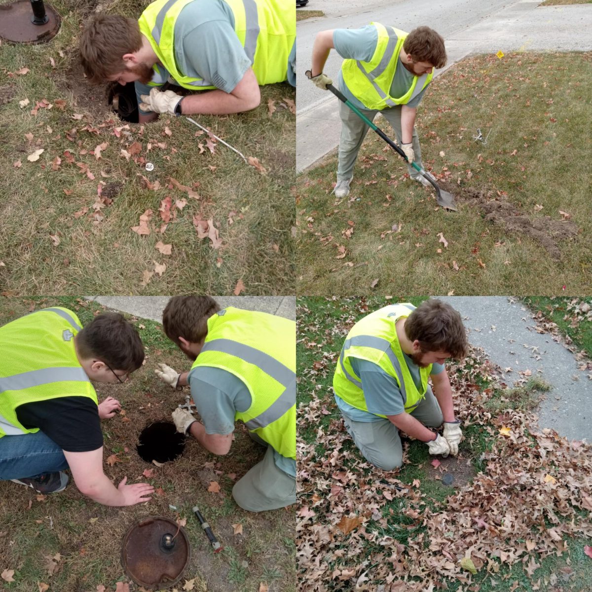
While out on the field working and earning money, he explained, “We are doing what GIS surveyors are doing. We are opening water meters in town, with two or three at a time wearing a vest. When opening the meter, we learn about varied materials and how to read the meters itself.”
“We are not only checking for lead and steel pipes, but we are also checking for leaks. If the water meter is going, especially if there is no one home, then we learn that there are leaks and relay that information to our supervisors of a leak in the house.”


